We apply operational computer-based satellite image analysis techniques, maintaining a leading edge in this fast changing field. The company has in-depth experience of a range of commercially available satellite imagery: in particular, IKONOS, Quickbird, SPOT, Landsat, IRS, ERS, Envisat and RADARSAT as well as aerial photography. We are constantly seeking to develop operational uses for remote sensing data where the unique capabilities and cost advantages of aerial and satellite imagery find practical application. Supporting this work is the in-house development of customized systems that incorporate remote sensing, GIS, GPS and database technologies. Using RS data/images for studying, monitoring and management of various resources like agriculture, forestry, geology, water, ocean etc. and mapping resource domains.
Ai??
Ai??Major application activities using satellite remote sensing data
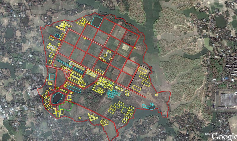
Using remote sensing image for land use planning.
-
- Ground water prospects and rechange zone mapping
- Wasteland Monitoring, Inventory and Assessment
- Coastal Zone Studies
- Forecasting Agricultural outpots using Space, Agrometeorology and Land based observation (FASAL)
- Agricultural Drought Assessment and Monitoring Syatem
- Biodiversity Characterization
- Urban Information System
- Water Resources Information System
- Space Based Information System for Decentralized Planning
- Flood Mapping and Monitoring
- Watershed Monitoring and Development