Name of the Client: RajdhaniUnnayanKartripakkha, Dhaka
- Overall Objective
Digital survey, map digitization and develop a web enabled plot based land record system for different Township/Housing Projects of RAJUK using GIS technology, updating/modification of existing Estate Management System (EMS) of RAJUK and linking the linking the oracle database of EMS with the developed GIS based program.
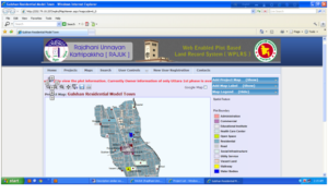
- Generate GIS map layers of Housing Estates by digitizing paper maps using ArcGIS software
iv)Major Activities/components completed in the project
- Digital Survey
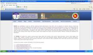
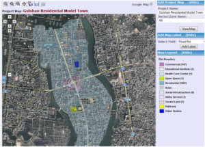
- Developed GIS and Web based Software WPLRS
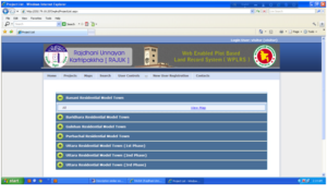
- Digitize Housing Estate Maps of
- GulshanResidential ModelTown
- Banani Residential ModelTown
- Baridhara Residential ModelTown
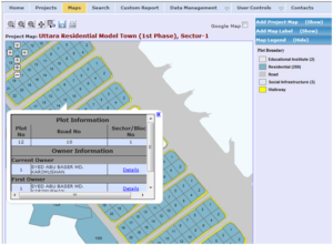
- UttaraResidential ModelTown1st Phase
- UttaraResidential ModelTown2nd Phase
- UttaraResidential ModelTown3rd Phase
- Purbachal New Town Project
Development GIS attribute data of above housing estates
- Completed GPS survey of all housing estates
- Projected all maps into BTM real world coordinate system
- Collected plot and plot owner`s information from hard record file of NHA
- Entered collected data into software database
- Scanned plot ownerai??i??s photo and edited all collected photos
- Installing software into RAJUK server
8. Given training on Software operation and GIS