Skip to content
Home
About
Information Technology
Nature and Environment
Natural Resource Management
Soil Resource Management
Agriculture and Fisheries
RS-GIS
Remote Sensing
Geographical Information System
Projects
Clients
Contact us
Search for:
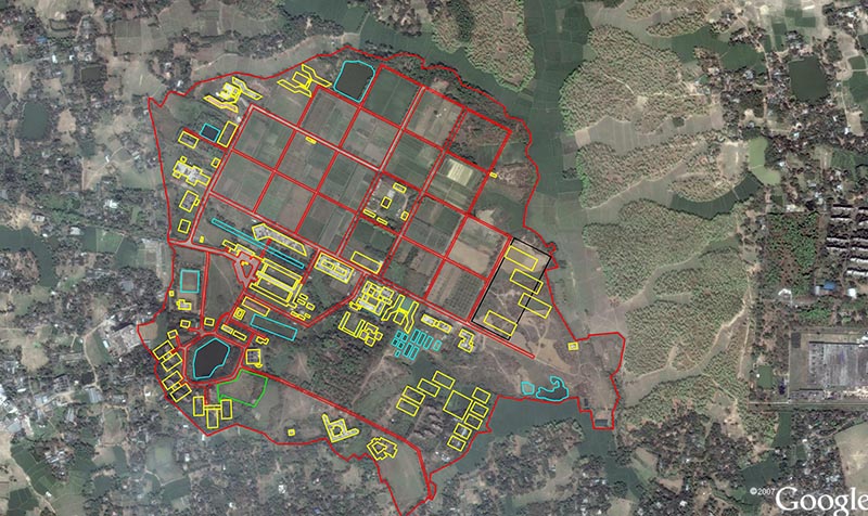
Using remote sensing image for labnd use planning
Home
Portfolio
Using remote sensing image for labnd use planning
Using remote sensing image for labnd use planning
twefsdf
Rajdhani Unnayan Kartripakkha
Khulna Development Authority
National Housing Authority
Chattogram Development Authority
BSMRAU
Cotton Development Board
Soil Resource Development Institute
Ministry of Agriculture
Robi
Katalyst
Scroll to Top